
Walk a Vernon Street
A sound Vernon by-street search moves from the current parcel to records that answer narrower questions. The Vernon assessor search accepts a property location and sorts matching results by address. It is the fastest way to collect the LSRN, MBL, owner, land class, acreage, zone, value, and assessment for each lot. An LSRN is the local system reference number, while MBL is the map-block-lot label shown for a parcel.
Do not treat the owner column as a list of everyone who lives there. Open the property card to compare the situs, meaning the physical property address, with the mailing address. Then use the GIS and recorded instruments to test whether each result is truly on the street and part of the same legal parcel.
- Choose Property Location, enter the street name, and record each address and LSRN.
- Open the card for situs, mailing, transfer, building, and valuation details.
- Use GIS Map to see parcel boundaries and lots on both sides of the road.
- Follow book, page, seller, and buyer clues into the Town Clerk deed index.
- Use voter or historical directory evidence only for the specific name and address being checked.
This Vernon street directory workflow preserves the difference between a tax owner, a mailing contact, and an occupant. That distinction is vital for business parcels, vacant land, multi-structure lots, and owners who receive mail outside Vernon.
Search Vernon Streets by Address
The assessor portal is free and needs no login. Its screen uses one text box, but the radio choice changes the search. Property Location is the correct mode for a street directory browse. Owner Name expects last name first and is better for confirming a known owner. Results have no visible year filter or public export, so record the card print date and save the identifiers needed for later checks.
| Portal control | Observed form | Best street use |
|---|---|---|
| Search By | Property Location or Owner Name | Select location before entering a road |
| Name | Text field with mode-specific hint | Enter a street name without depending on a house number |
| Results | Address-sorted scrolling table | Capture LSRN, address, owner, class, zone, acreage, MBL, and values |
| Open Card | Parcel-card button | Compare situs, mailing, transfers, and structures |
| GIS Map | Parcel viewer link | Confirm location and adjacent lots |
| Building File | Shown when available | Check address-linked building material |
A zero result says only that the entered form did not match. Try the base street name, spacing variants, or the prior owner. Vernon has not published a full historical range or an export control for this assessor screen.
Note: A parcel card proves a tax and ownership link, not every person who occupies the address.
Map the Vernon Street Grid
The Vernon GIS Map Viewer turns the assessor list into a geographic check. Turn on Parcels, Parcel Labels, and Acres, use Find to reach the road, and use Identify on a visible lot. The assessor can pass an LSRN into the map through a parcel link. That small handoff helps prevent a similar street name or mailing address from sending the search to the wrong tract.
The viewer also offers zoning, FEMA flood layers, civic points, and imagery from 2016, 2019, and 2023. Those layers explain land use and physical change, but they do not identify residents. Draw and Measurement can define a segment; Print can preserve the map used for research. For an official overview, the town also maintains its GIS maps and information page.
Open the official Vernon parcel viewer before reviewing the captured interface below.
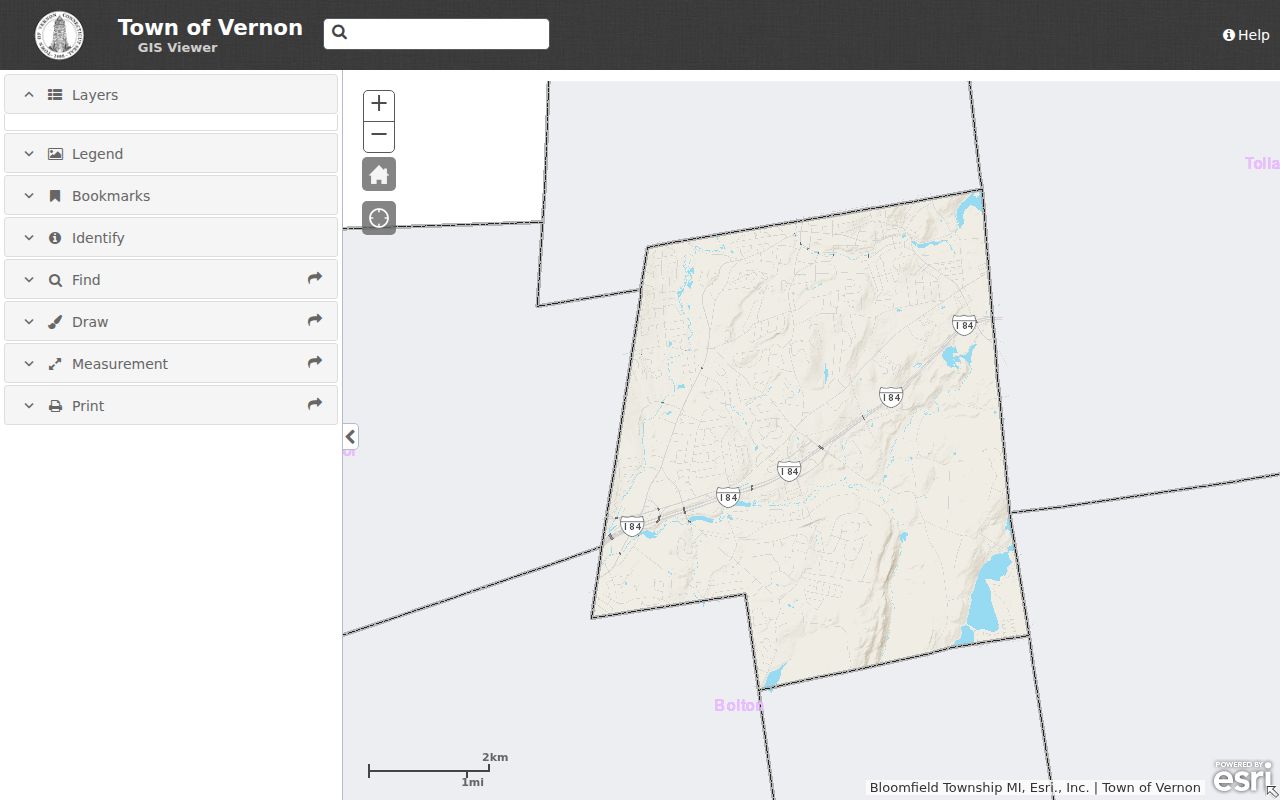
The image shows why GIS works as the map layer of a street directory, while the assessor card remains the source for ownership and mailing details.
Vernon Records Along Each Street
No single Vernon record supplies a complete household roster. Each source answers a different address question, and some need an office request when the public portal stops. The street directory is strongest when every result carries its source date and parcel identifier.
| Address source | Custodian | What it can establish | Access route |
|---|---|---|---|
| Assessor card | Vernon Assessor | Owner, situs, mailing, class, zone, acreage, transfers | Free portal, card, office, phone |
| GIS parcel | Vernon GIS | Boundary, MBL, adjacent lots, map context | Free viewer, Identify, Print |
| Land records | Vernon Town Clerk | Grantor, grantee, instrument, legal description | SearchIQS, clerk books, copies |
| Tax account | Collector of Revenue | Bill type, balance, payment context | MyTaxBill and definitive office receipt |
| Permits and code | Building and Enforcement | Project, permit, inspection, land-use context where public | OpenGov, counter, email, written request |
| Voter record | Registrars and Secretary of State | A specific registration match under access limits | Name-oriented lookup or restricted file process |
Online access is only one channel. Call the Assessor at 860-870-3625, the Town Clerk at 860-870-3662, or Building at 860-870-3633 when a linked card, old image, or permit cannot be opened. A focused mail or Connecticut FOI Act request can seek non-exempt administrative records by address, LSRN, and date range.
Follow Vernon Deeds by Street
The SearchIQS Vernon land-record portal connects present parcels to recorded instruments. Start with the current card's transfer date or book and page. A grantor transfers an interest; a grantee receives it. Read the deed's legal description, prior reference, lot, acreage, easements, and map references before concluding that two addresses describe the same land.
Vernon's online span changes by record form. Land images begin July 17, 1992, while the index reaches July 1, 1964. Earlier instruments and pre-1992 images require the Town Clerk's books, office copies, or a targeted request. The map index begins July 4, 1853. These cutoffs matter along an old road because an index hit without its image is a lead, not the whole deed.
- Parcel
- A mapped unit of land identified in the town tax system.
- Situs address
- The physical address of the property, which may differ from the owner's mailing address.
- Plat
- A recorded map that lays out lots, boundaries, roads, or a subdivision.
- Criss-cross directory
- A directory arranged by address or telephone number rather than only by surname.
Vernon Permits by Address
Vernon moved current building and zoning applications to OpenGov. The public screen did not expose a reliable historic search-field list during research. If the current application is not visible, ask Building for the work address, approximate date, permit number if known, and project type. Public file material may identify an applicant, project, inspection, or certificate, subject to lawful exemptions.
Property Maintenance and Zoning Enforcement has address-keyed files, but no public case index was located. The same fallback applies: use the office, phone, email, mail, or a narrow records request. GIS utility layers show service context only. No public utility customer list was found, so a mapped pipe or service line must never be used to infer a named resident.
Note: Vernon parcel cards may change after the 2026 inspection and revaluation, so cite the card's own print date.
When Vernon Addresses Disagree
A parcel can be in Vernon while its owner receives tax mail elsewhere. The Historic Talcott Mill sample card, for example, carries a Main Street situs and a Hartford mailing address. That is not an error. It shows why a street directory must keep the two fields separate. The mailing line points to the tax contact, not to who occupies the Vernon site.
The same caution applies to a property held by a company, a parcel with several buildings, or land with no dwelling. Combine the assessor class, GIS shape, card structures, deeds, and a specific name-based resident source. Even when situs and mailing match, that alignment supports only a cautious inference of owner occupancy.
Vernon Voters Are Not Street Lists
Connecticut's public voter-registration lookup is oriented to a person's name, town, and identifying details. It is not a public browse of everyone on a road. Vernon Registrars maintain the local file and can explain lawful access for a specific civic purpose. The statewide voter file has a $300 written-request process and use restrictions; the state describes birth year rather than full birth date as releasable.
Protected voters and Safe at Home participants may have names or actual addresses suppressed. A registration match also does not prove every household member or current occupancy. Use it only to test a known person-address link, never to create or publish a casual road roster.
Vernon's Vanished Market Street
Market Street disappeared during Rockville urban renewal in the 1960s. An old address there will not resolve through a modern Vernon street search. The practical bridge is the deed's legal description, 1869 owner maps, Rockville Sanborn sheets, newspapers, and directory entries. Vernon and the former City of Rockville also consolidated on July 1, 1965, so town labels can shift even when the family or parcel did not.
No complete town-wide renumbering or renaming table was found. Avoid forcing an old house number onto a current parcel. Use a dated map and book-page reference, then record the confidence of the match. This local address trap is exactly where the map-based method outperforms a plain search box.
Past Vernon Residents by Street
Rockville and regional directories reach back to the late 1870s. They can list a resident name, occupation, work or home address, and later telephone clues. A verified complete reverse-directory run was not found online, so ask Rockville Public Library whether a particular volume has a street or criss-cross section. If it does not, inspect its street index and pair the entry with maps and newspapers.
The Vernon city directory collections hold the full shelf details. For current street work, use them only when the question shifts to past residents or an obsolete road name. Library staff can be reached at 860-875-5892, and in-house local-history material may require identification while in use.
Limits of Vernon Street Records
A Vernon street directory can show parcels, tax owners, recorded transfers, visible permit history, and carefully verified historical names. It cannot reveal every renter, family member, visitor, unlisted phone, utility customer, DMV address, sealed court party, or protected voter. A missing portal hit is not proof that a person or record does not exist. Older books may be at the Town Clerk, while directories and maps may be in the library or historical society.
Commercial neighbor tools may combine stale or mismatched addresses. Official records are slower but make the custodian, date, and record type clear. Keep notes on the exact street spelling, parcel number, source date, and whether a name came from ownership or residence evidence.
Lawful use. Use Vernon address records for genealogy, property history, civic research, or personal safety. Never use them to stalk, harass, intimidate, or harm anyone.
For a deeper search into one known person, use the Vernon resident lookup and keep the address evidence separate from identity proof.